"The whole trek is blanketed by tall blue pines"
Hikes are an amazing way to really see the world and make unforgettable memories. There are many great hiking tracks around the world and Pakistan is certainly not short on them.
Pakistan has a lot to offer from great food, culture, entertainment and architecture, there is a lot one can experience in the country.
However, not many people know about the extraordinarily diverse and natural beauty that Pakistan has to offer.
It is a beautiful country that is home to some of the best hiking trails in the whole world. It is also the home to 108 mountain peaks that are above 7000 metres.
Locals and foreigners love the country’s hiking spots.
Majestic meadows, snowy mountains, wildlife and gushing rivers – Pakistan is packed with breathtaking habitats.
However, hiking can be dangerous if you are not familiar with the route or where it is safe to camp.
In particular, this is the case in Pakistan where the trails are not always as straightforward or accessible.
Luckily, there are many videos on YouTube and information guides out there that can help you prepare and get you clued up on what to expect.
Hiking can be an enjoyable event and provides you with a once in a lifetime experience that you will always remember.
The hikes mentioned vary in intensity, however, all are guaranteed to offer captivating views of Pakistan’s natural culture.
So, without further ado, DESIblitz takes an in-depth look at Pakistan’s scenic hikes and the varying artistry that they all offer.
Margalla Hills
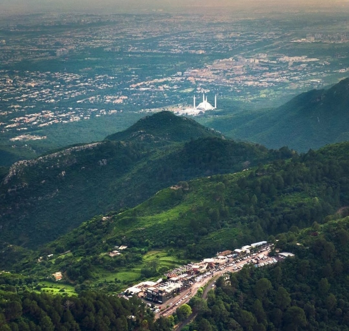
Islamabad is coined as one of the most beautiful capital cities in the world. If you have ever been to Islamabad you would have noticed the gorgeous hills in the city.
Margalla Hills, located north of Islamabad, is a hill range that is part of the Himalayan foothills. It consists of many valleys and high mountains and it covers an area of 12,695 hectares.
There are some popular places located on the Margalla Hills, these consist of Daman-e-Koh, Monal, Pir Sohawa and Margalla National Park.
Daman-e-Koh is a garden viewing point in the middle of the hills. It is a great midpoint spot to re-energise and see the surrounding nature of Islamabad.
Check out this drone view of Daman-e-Koh:

In addition, Monal is a popular restaurant on the Margalla Hills, it is a few kilometres above Daman-e-Koh. Here, you can bask in the scenery whilst enjoying sumptuous food and music.
Impressively, Margalla Hills also has a tourist holiday resort called Pir Sohawa. Found at the top of the trail, the resort is breathtaking.
It allows tourists and locals to wine and dine in the breathtaking greenery of Islamabad whilst getting treated to a spectacular atmosphere.
Margalla National Park is the third-largest national park in the world.
It consists of the Margalla Hills, Shakarparian Park and Rawal Lake, which is an artificial reservoir.
The Margalla Hills is a popular spot for daytime hikes for people living in the capital. A review left by INK64 mentioned:
“The most beautiful natural part of Islamabad is Margalla Hills, whenever you visit Islamabad it would not be completed without a tour of Margalla Hill.”
There are eight different trails you can go on, which all offer particular experiences and intensities. The most popular trails are trails 1, 2, 3 and 5.
Trail 1
Trail 1 begins at E-8 Sector, just in front of the National Defense University, and ends at Talhar Village.
In approximately two hours, the track will lead you to the top of Pir Sohawa Road and an extra 20-minute walk can get you to Monal Restaurant.
Trail 1 is great for adventure seekers, as the track has some sub lanes to explore. At the first rest point, you can see the Faisal Mosque and some fascinating views of Islamabad’s sunset.
Trail 2
Trail 2 starts off near Islamabad Zoo and takes you up to the Daman-e-Koh viewpoint. You would reach the viewpoint within one hour.
The trail may be only short, but it is steep. However, this route makes for a great Sunday morning hike with the family, as it’s not too long or extraneous.
Trail 2 doesn’t just end at the Daman-e-Koh viewpoint, if you wish, you can go further up.
The trail has a 1.4km extension trail that starts just opposite Daman-e-Koh’s parking and leads to Cactus Ridge, which offers a wider view of Islamabad.
Trail 3
The enjoyable Trail 3 is one of the most used trails of the Margalla Hills and it is the oldest hiking trail in Islamabad.
Trail 3 begins opposite Sector F-6 on Margalla Road and in 30-50 minutes, hikers can reach the viewpoint.
From this viewpoint, you can see some great sights of Islamabad, including most of the major buildings and monuments.
You can stop at this point if you wanted a casual stroll. However, hiking enthusiasts will be happy to know that the trail does not stop there.
If you carry on, you will pass through herds of greenery going uphill. Trail 3 is a lot steeper, therefore it is far more challenging but also more rewarding.
At frequent points on Trail 3, there are benches to take a well-deserved rest.
It is important to bare in mind that there are no water sources along the trail, so take a bottle of water with you – you will definitely need it!
If you hike for another 40-60 minutes from the first viewpoint then you will reach the Monal restaurant on Pir Sohawa Road.
Traveller Hasan Zir* praised Trail 3 and admitted:
“Family and I go hiking here at least once per week. Overall the best trail in Pakistan that I’ve been on.”
“Nice views of the city starting after about a ten-minute hike, and they continue to get better the further up you go.”
Another review left by a hiking enthusiast advised:
“Get there early in the morning, bring lots of water and have fun making your way up to Monal restaurant for some lunch.
“The trail offers some challenge if you are new to hiking, but the surrounding nature and astounding views from the top are worth it.”
Trail 3 is a popular one for hikers, due to the ease of access, resting places and clarity of the trail.
Check out this great video showing Trail 3’s elements:

Trail 5
Last but certainly not least, Trail 5 begins at Margalla Road, a few hundred meters from Trail 3.
The path leads you to the top of Pir Sohawa Road, however, this route includes 3 sub trails. It will take you up to four hours to cover this hike but it is worth it.
Immy Khan*, a hiker from Pakistan revealed:
“Trail 5 starts out at a nice stream and patchy rock paths then leads to higher areas where springs and waterfalls glisten the rocks.”
It is a popular trail, due to the water stream, which makes a great picnic spot.
About half of the trek is much more rigorous, as it is steeper, however, the views are worth it. The trail finishes close to a security check post on Pir Sohawa Road.
Once at the top if you walk another 500m west then you would reach the Monal Restaurant. An avid Pakistani hiker, Ashraf Bidal*, mentioned how Trail 5 provides a beautiful, yet straining hike:
“The streams of water really make it a pleasant ‘walk’ up to this point. After the 2km mark is where it gets steep and sharp.”
“The elevation continues relentlessly for several 100 meters and one will need to catch their breath often.”
Another hiker, Seema Ali* advised:
“Trail 5 is accessible and can be enjoyed in all seasons. During the summers an early visit is recommended, while in winter, a late start will be more comfortable.
“In the monsoon season, the trek offers a pleasant walk next to a freshwater stream for the first two km.
“You’ll pass by small waterfalls and lagoons on the way, and will need to cross the stream at a couple of places.”
There’s no doubt that the different trails that Margalla Hills offers all encapsulate the naturalistic beauty and culture of Pakistan.
Check out this video of the waterfall on Trail 5:

Which Trail is Best for You?
Trails 1 and 2 are good if you are looking for a shorter casual hike, they are both great for beginners. However, Trail 3 is a good option if you are experienced in hiking.
A survey conducted by The Tribune, in which they asked peoples opinions on the best trails, provided a mixed view on the Margalla Hills trails.
Adnan Anjum, an Islamabad native, mentioned how Trail 3:
“Is much more scenic in comparison to the other ones. You can see the face of entire Islamabad while going uphill.”
While Zeeshan Haider, a media worker in Islamabad, said:
“Trail 3 is the real hike. Trail 5 is the most scenic.”
Whichever pathway you decide to go on you can ensure you will be seeing some amazing views of Islamabad.
Fairy Meadows & The Nanga Parbat Base Camp
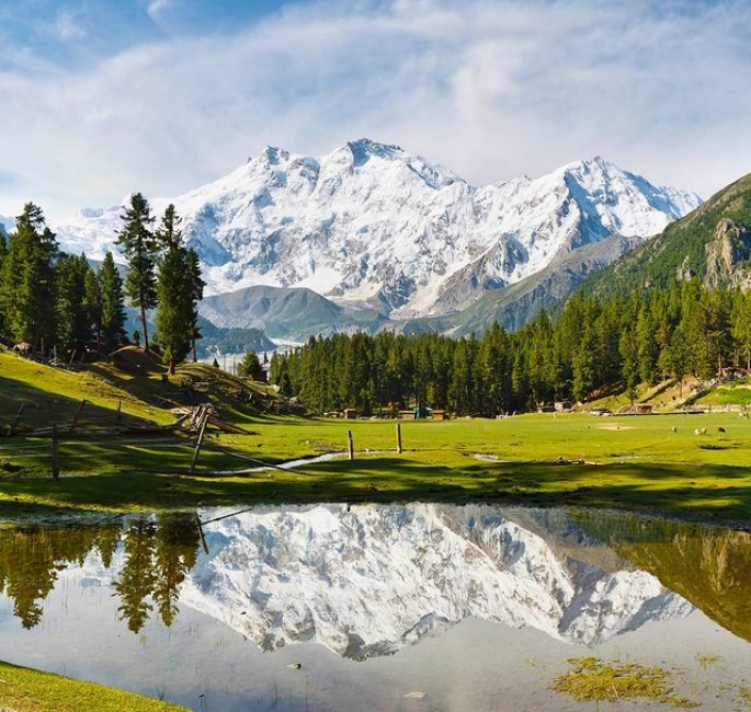
The next scenic hike is incredibly gorgeous and is frequently referred to as “heaven on earth”.
Fairy Meadows is grassland which is near a campsite of the Nanga Parbat, located in Diamer District, Gilgit-Baltistan.
From Fairy Meadows, you can see the Nanga Parbat mountain, which is the ninth highest mountain in the world and the second-highest in Pakistan.
Fairy Meadows is considered to be the most beautiful place in Pakistan.
It is not just the name that sounds mythical, the place itself is truly magical and you are bound to fall in love with it.
The best time to visit Fairy Meadows is either April/May or September/October. During these months the weather is slightly cooler so visitors aren’t getting scorched by the sun.
There are different stages you will need to go through before reaching Fairy Meadows and the Nanga Parbat Base Camp.
First of all, hikers will have to make their way to Gilgit-Baltistan. From Islamabad, they can either get a plane or an 18-hour bus ride.
To begin the journey to Fairy Meadows, a 16 km Jeep ride is needed.
It starts on the Rakhiot bridge on the Karakoram Highway and takes you all the way to the village Tato, where the road ends.
The Jeep ride will not be one of your most relaxed car journeys and is certainly not for the faint-hearted.
The roads are very narrow and steep and are up there with the worlds most dangerous highways.
For this reason, the road is only open to locals that provide transport to visitors.
Check out this video showing the Jeep ride by travel page @explorewithlora:
@explorewithlora The road to Fairy Meadows, Pakistan – would you drive here? #pakistan #pakistantravel #dangerousroad #bucketlist #visitpakistan #fyp #tiktoktravel
Once you reach Tato, the road ends so you will need to hike up a 5km trek to Fairy Meadows. The hike takes over three hours, depending on your fitness levels.
Once you reach Fairy Meadows, there’s no denying that the serene elegance of the place will take you back.
Asad Hunzai, a photographer from Pakistan mentions how Fairy Meadows is:
“A very peaceful and relaxing place to enjoy the mountain view, soaking in the atmosphere and hospitality of the local people.”
When it comes to accommodation, there are a few places you can stay that give you amazing views of Fairy Meadows and Nanga Parbat. These include:
- Greenland Hotel at the centre of Fairy Meadows. It includes a number of detached cabins and areas for camping.
- Shambala Hotel is located 200 metres away from the main area, so if you are looking for somewhere a little quieter, this is a good option.
- Raikot Serai provides a prime view of the Nanga Parbat from the cabin.
There are also other cabins and campsites at Beyal camp, which will require you to hike an extra 45 minutes from Fairy Meadows.
Check out YouTuber Alina Hayat’s breathtaking setting from her cabin:
@alinahxyat my heart is in fairy meadows ?? #fyp #foryoupage #travel
The adventure does not just stop at Fairy Meadows, from there you can hike to the Nanga Parbat base camp.
The trek is eight hours but offers numerous stops along the way where travellers can rest, relax and recuperate.
You can hike from Fairy Meadows to Beyal camp, then from Beyal camp to the Raikot glacier viewpoint and finally to the Nanga Parbat base camp.
At Beyal camp, you will be able to see glimpses of the Nanga Parbat. It is located in a valley and takes approximately 15 minutes to get through the village.
Beyal camp to the Raikot glacier viewpoint takes 50 minutes and is a gradual uphill trail.
At the viewpoint, you can see landscapes along the Raikot glacier, as well as the Nanga Parbat, Chongra Peak, Raikot Peak and Gnalo Peak.
Many stop their journey here and head back to Fairy Meadows. However, hiking further will expose you to even more astonishing backdrops like pristine lakes and stunning wildlife.
From this viewpoint, it can take up to two hours to get to the Nanga Parbat base camp.
It is a difficult hike and the conditions of the trail are very different, in comparison to the rest of the hike. This is because the route becomes very steep and rockier at this point.
Previously, the trails took you through valleys and greenery, but at this point, you will be hiking along the edge of the glacial valley.
Along the way, you will also see superb stream crossings and memorable mountain peaks.
Nanga Parbat base camp provides a dazzling ambience. Many have said that it is the most stunning relaxing place due to how quiet it is.
Many are used to the bustling streets of Pakistan but these tranquil settings show how diverse Pakistan’s culture is.
Check out this video of the Fairy Meadows and the Nanga Parbat base camp:

Chitta Katha Lake
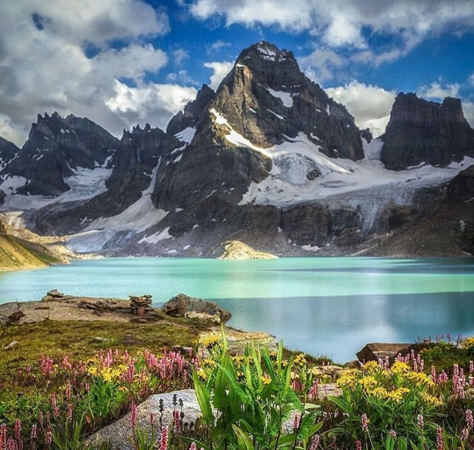
Pakistan offers the best paradise lakes with the clearest water and Chitta Katha Lake is no different. This is a great spot to hike to in the summer months, between April and September.
Chitta Katha Lake, which translates to ‘white stream’, is an alpine lake located in Shounter Valley in Azad Kashmir.
The lake is surrounded by the Hari Parbat mountains range, as well as the Nanga Parbat and K2, the second-highest mountain in the world.
The Indian occupied Kashmir border is not that far from the lake area.
While the lake itself is gorgeous, on your journey there you get to see the unparalleled presence of nature in Northern Pakistan.
First of all, you would need to make your way to Kel, a village in the Neelum Valley in Azad Kashmir. On the way, you will see many water streams and meadows.
If you are travelling from the capital, Islamabad, then it would take roughly 10-11 hours by car. When arriving in Kel, many people spend one night in a hotel before making their way to the next spot.
Next, you will have to make your way from Kel to Shounter. Like similar trails in Pakistan, a Jeep driven by a local driver is required. As the roads are very dangerous and rough, a skilled driver is needed.
The Jeep ride to Shounter takes over two hours and once reached, there is a base camp where hikers can camp and hire a guide for the next part of the journey.
It is advisable that travellers hire a guide, especially if it’s the first time they have experienced this route.
If you want to make a little detour then Shounter Lake is a 25 minute Jeep ride from the base camp.
Now, to actually get to Chitta Katha Lake, hikers will have to trek from Shounter to Chitta Katha Lake.
The hike to the lake takes up to 12 hours and is almost 4000 metres.
It is a tough hike, but 100% worth it. Along the way, locals and tourists are treated to lavish scenes from alpine forests to vibrant forests.
In addition, there are technically three parts to this hike:
- Base camp to the village Dak.
- Dak 1 to Dak 2.
- Dak 2 to Chitta Katha Lake.
The whole trip would take around three days to complete. Hiking to Chitta Katha Lake provides an outstanding memorable experience.
The lake is one of the most scenic areas in Azad Kashmir and is certainly striking. It is a lovely serene destination, just listen to the sound of nature in this clip by ‘Let’s Travel Pakistan’.
From the lake, you will get to see the stunning Nanga Parbat in the distance. Take a look at the aerial view of the vibrant Chitta Katha Lake:

Miranjani
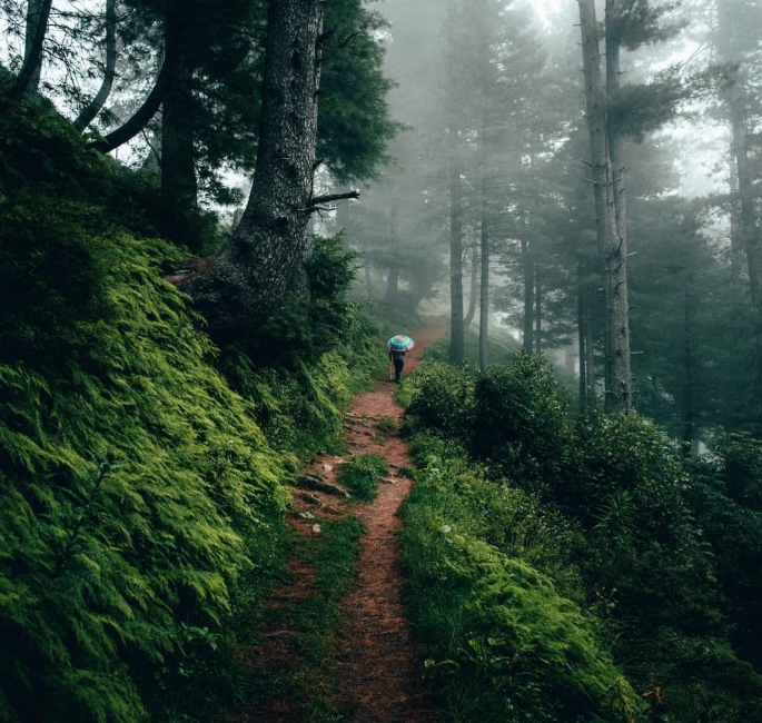
Miranjani, 80km north of Islamabad, is the highest peak in the Galyat region. It is located in the Abbottabad District of the Khyber Pakhtunkhwa province.
The trip starts near the Governor House in Nathia Gali and the track is just under 5000 km.
Depending on your fitness level you can reach the top in three hours, absorbing the organic scents and scenes of your surroundings.
At its highest point, you can see the colourful peaks and resorts of Mushkpuri Peak, Azad Kashmir and Nathia Gali.
If it is not cloudy, hikers can see a glimpse of the snowy Nanga Parbat mountain in the distance. It is over 400 km from the spot which emphasises how vast these treks are.
During this trip, you will see an abundance of tall pine trees and greenery. Many hikers love this track for its serene location, a review by Tahirrazahir111 mentioned:
“Miranjani is an extremely beautiful place, the high steep lush green mountains, with many bushes full of berries, and beautiful flowers, and the chill in the air, makes it even more beautiful.”
Also, hiker Qazi Irfan revealed:
“Miranjani Trek is a feast for hiking lovers and even beginners.”
He further expressed:
“The whole trek is blanketed by tall blue pines and the voices of crickets make the journey more exciting.
“The last patch of the trek is a bit harsh and elevated with sharp rocks, but good sports’ shoes with stick may ease it.”
With such a versatile array of landscapes, these routes are hotspots filled with engrossed explorers.
Check out this video by PoV Tube which goes through the track:

Dunga Gali-Ayubia Track
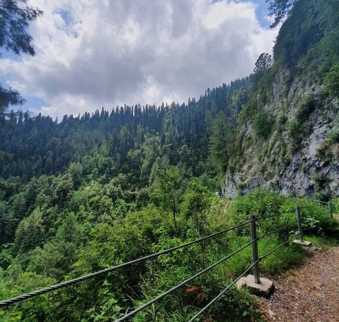
Dunga Gali-Ayubia, more widely known as the Pipeline Track, is a historic walking track in Pakistan.
The Pipeline Track follows an important water pipeline that serviced the historic hill station of Murree.
Murree was constructed in 1851 for British troops to use as a sanatorium, however is now a popular holiday destination.
This track starts off in Donga Gali and ends at Ayubia.
Donga Gali is a town in the Galyat area of Ayubia National Park, which is located in the Khyber Pakhtunkhwa province.
The Pipeline Track is an easy track. It is about a 5km hike and takes up to four hours.
Along the track, you would be able to see the striking pine forests. Many have described the views as “exotic” and a “dense jungle”.
Jauharabad native Naeem Akhtar praised this location, describing it as a:
“Clean environment and lush green jungle. Hundreds of thousands of trees. Clean oxygen to breathe. Good experience.”
Avid traveller, Muhammad K, claimed the easier track is better, as it allows you to lounge in the surroundings:
“For a regular tracker, this one is considerably easier. But the scenery along the way is breathtaking.
“I think if the track was difficult you won’t be able to enjoy the scenery along the way.”
Not only that, the journey is an enticing one for wildlife lovers. On the mission towards the top, various species of birds fill the towering trees.
Not only that but the hike can also be completed by horseback. Allowing explorers to take pictures, soak in the sunlight, and experience tranquillity.
Check out this video of a section of the Pipeline Track:
@irshadafridi4 Nathia gali pipe line track#DilDilPakistan #explorepakistan #foryou #foryoupage
This cluster of scenic hikes is the most valued way in appreciating the deep natural culture of Pakistan.
Pakistan’s beauty is something you need to see once in your life. If you ever get the chance to visit Pakistan then these decorative spots need to be on your list.
With the aid of this guide, these trails can be enjoyed to their full extent.
Although, other notable routes which illustrate Pakistan’s beauty and wonder include Barah Boq, Naltar Valley Lakes and Patundas. The experiences are endless.
With such a great mix of city life and nature, it’s inevitable that swarms of people are drawn to these locations all year round.


